Gathering environmental measurements through heterogeneous wireless technologies
NITlab demonstrate the development of a wireless metropolitan network using public transport in the city of Volos, by exploiting the combination of heterogeneous wireless technologies. Environmental measurements are gathered from sensor devices attached to Android smart phones carried by buses’ passengers and are associated with GPS data gathered from the phones.
Considering the absence of WiMAX-enabled smart phones in the market of Greece, NITlab has equipped several city buses with WiMAX to WiFi gateways. An Icarus node plays the role of this gateway inside the bus, featuring two wireless interfaces, a WiFi and a WiMAX. The gateway provides internet access to the bus passengers, by bridging traffic from one interface to the other. The local network is using the WiFi technology and the connection with the internet is accomplished through the WiMAX interface.
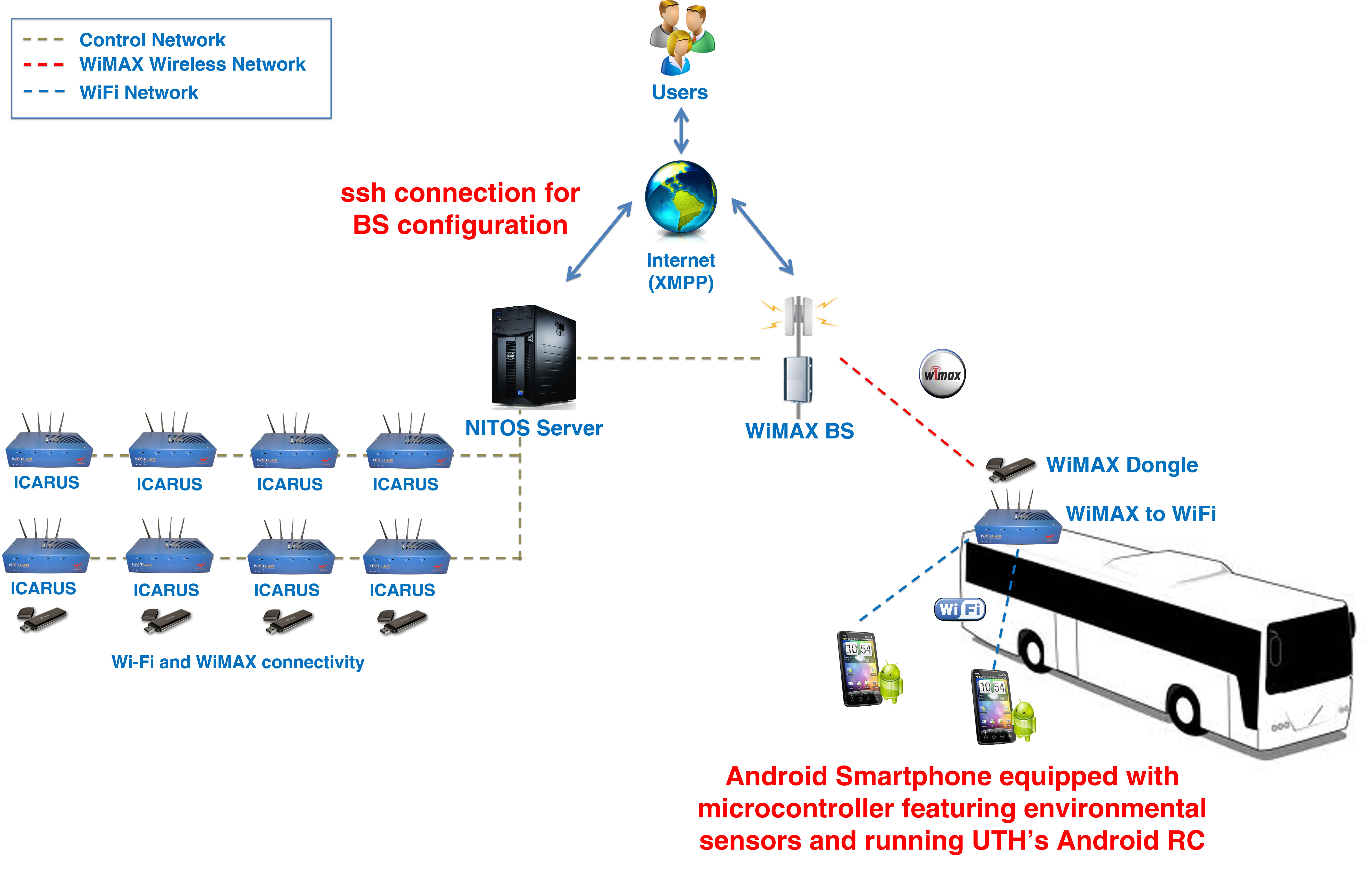
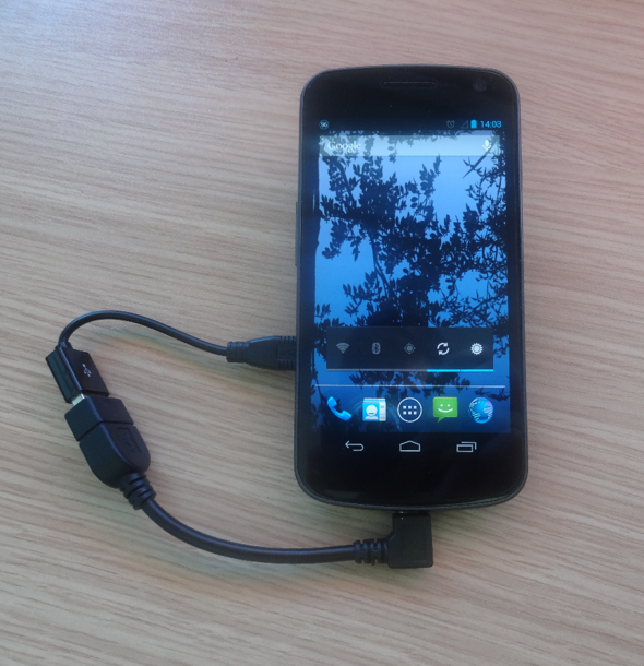
A passenger is carrying an Android smart phone, with UTH’s Android Resource Controller (RC) and UTH’s mobile application both installed on it. Furthermore, the Android phone is connected with an external small-sized device, the teensy 3.0 microcontroller board that features environmental sensors and provides to the smart-phone the perceived measurements. The RC is running constantly as a background service and is responsible for the initialization or termination of any chosen compatible mobile application and mobile interface. On the other hand, the mobile application is an Android application that samples the GPS and the microcontroller and aggregates the measurements in a SQLite database both on the smart phone and on the NITOS Server.
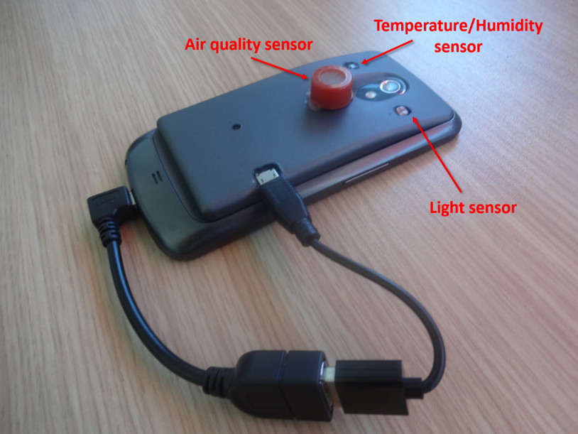
The experimenter runs an OMF experiment and triggers UTH’s mobile application in the background, using the Android RC. During this process, the Android user has full control of his/her handset device. After the initialization of the experiment, the mobile device uses the existing WiFi network and pushes measurements to the NITOS Server. These measurements are environmental data, such as humidity, temperature, light and gas measurements, that have been gathered from the microcontroller.
Each time a sampling is performed the mobile application collects the GPS values and assigns them to all the collected measurements from the microcontroller.
On the server side, UTH’s Measurements Depiction Framework is used to gather the values of each sampling effort and depict them on a Google map. This process is implemented as a service and inserts location points on the Google map each time the database is updated. Each depicted map location point is clickable and pops up an info window with the collected measurements, when someone clicks on it.

Finally, the mobile application is delay-tolerant, so in case the handset device loses internet connection, the application stores the measurements and sends them to the server as soon as the connection is restored.